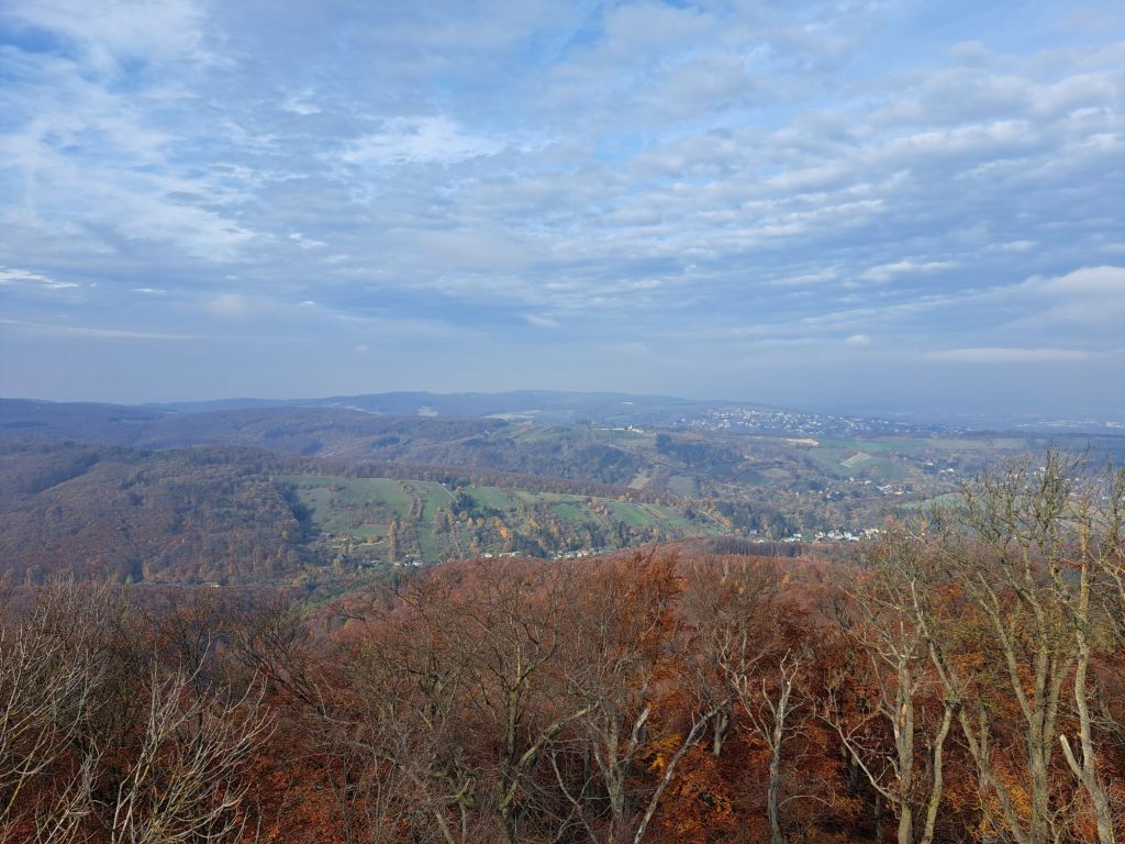
A mild November Sunday and I took a walk with friends to the highest point in Vienna, the Habsburgwarte in the 19th district. Altitude: 542 m. I’d been to the Warte before but never when it was open. This time, I was able to climb the tower and admire the view from the top. What an amazing city! ❤️
We did it! We finally finished the Rundumadum hiking trail. And only 😉 two and a half years or so after we went hiking together the last time, as described here. We managed to pick the perfect day for it, too. It was sleeting and windy and, of course, rather icy under foot with all that sleet. But, as we agreed, there is no such thing as bad weather, only inappropriate clothing, so we pulled on our warm and water-repellent things and went out.
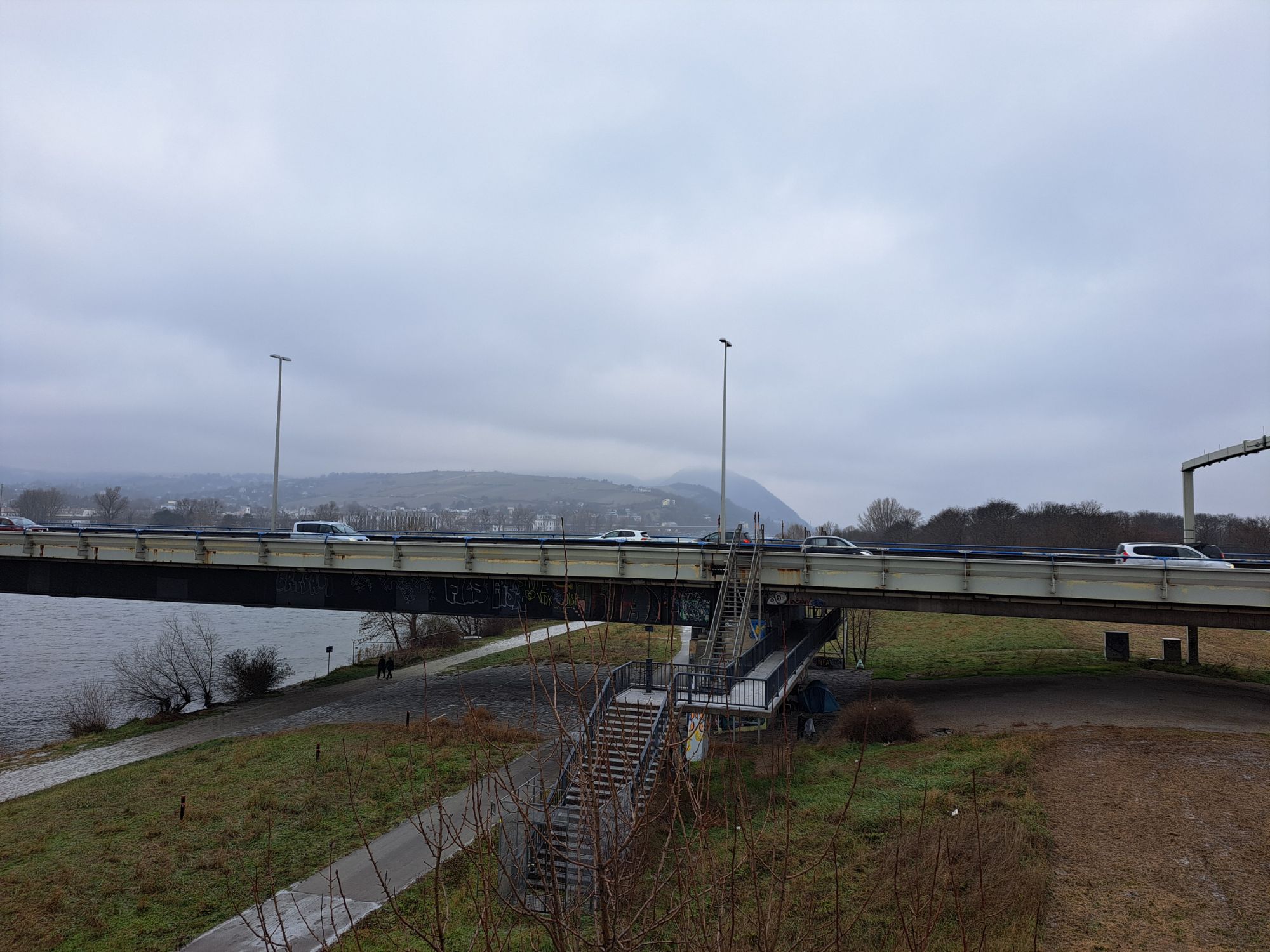
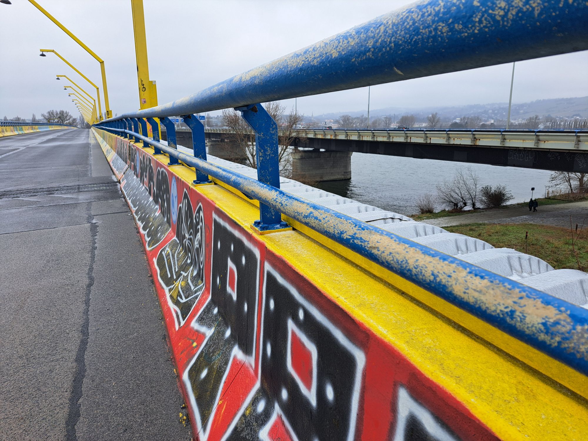
As I mentioned in that post from May 2022, we didn’t manage the whole last stretch in one shot and so just had a couple of kilometers to go this time. We took the 34A bus from Floridsdorf more or less to where we stopped last time and set off from there in the direction of the Danube. Remarkably, given that we had often had trouble with the directions and missing trail signs, we didn’t have to re-trace our steps once. We found the pedestrian overpass that allowed us to cross the Autobahn first try and found ourselves walking along the banks of the Danube where the wind was, if possible, even stronger.
Other than a few hardy dog walkers, some with rather unhappy looking dogs, and a couple of joggers, we were the only ones crazy or driven enough (“We *will* finish it today”) to be out. Oddly enough, I can’t say it was unpleasant. We had enough to talk about, the scenery is always beautiful, and we were about to complete a journey I started alone in November 2018, if my memory serves me correctly. (Here is that first Rundumadum post with some photos of the stretch in friendlier weather.)
We found the Jedlerseer Brücke (bridge) easily and crossed to the Donauinsel, I remembering the first time I did that, with Maylo, who had to be carried part of the way. (He never did get used to bridges.) Then we transversed the Donauinsel, waved to Nussdorf, where we were headed, on the other side of the Danube, and followed the trail southeast to the next bridge and crossed. We came out quite close to the Heiligenstadt U4 station, and it was a little tempting to just stop there. However, we walked out to Heiligenstädter Straße and walked northwest to Nussdorf, the official end of that trail section. We were rewarded with a combination of some of the most famous “Gemeindebauten” or public housing blocks, including the Karl-Marx-Hof, and some beautiful 19th-century privately owned apartment buildings.
In Nussdorf, we congratulated each other and went back to my hiking partner’s place for some much needed Glühwein and Christmas cookies.
Up next — the city’s 14 “city hiking trails” (“Stadwanderwege”), which include some as short as 4 km and one as long as almost 23 km. (I suspect we won’t be walking that long one in one go!) Most of them seem to be between 10 and 12 km.
Below are a few photos from today’s walk, mainly to show the sleety, foggy weather. The last one also shows that we did make it all the way to Nussdorf.
Trail number 24
Distance: 7.8 km (of which we did three or four today)
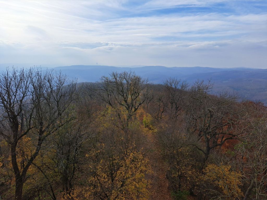
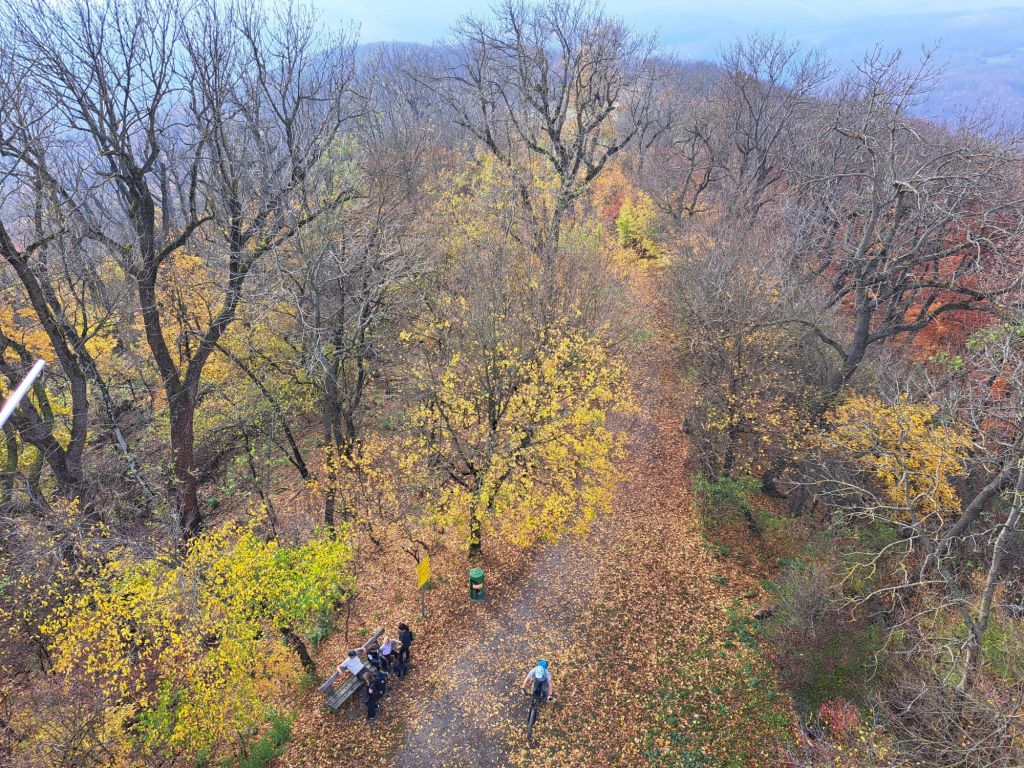
Actually, I already took quite a hike last weekend (Sophienalpe) but didn’t have time to upload photos so you are getting a couple of photos from yesterday’s hike on Wilhelminenberg. As I am fond of saying, “And it’s all within the city limits!” (A friend of mine from London, having heard this multiple times over a couple of hikes, commented, “That seems to be quite important to you.” Yes, it is!)
The big difference between last week’s hike and this was that yesterday, suddenly, the woods smelled autumnal. They had that special sent of fallen and just-starting-to-rot leaves as well as mushrooms.
Whatever time of year, it is all very beautiful, even when the sun isn’t shining.
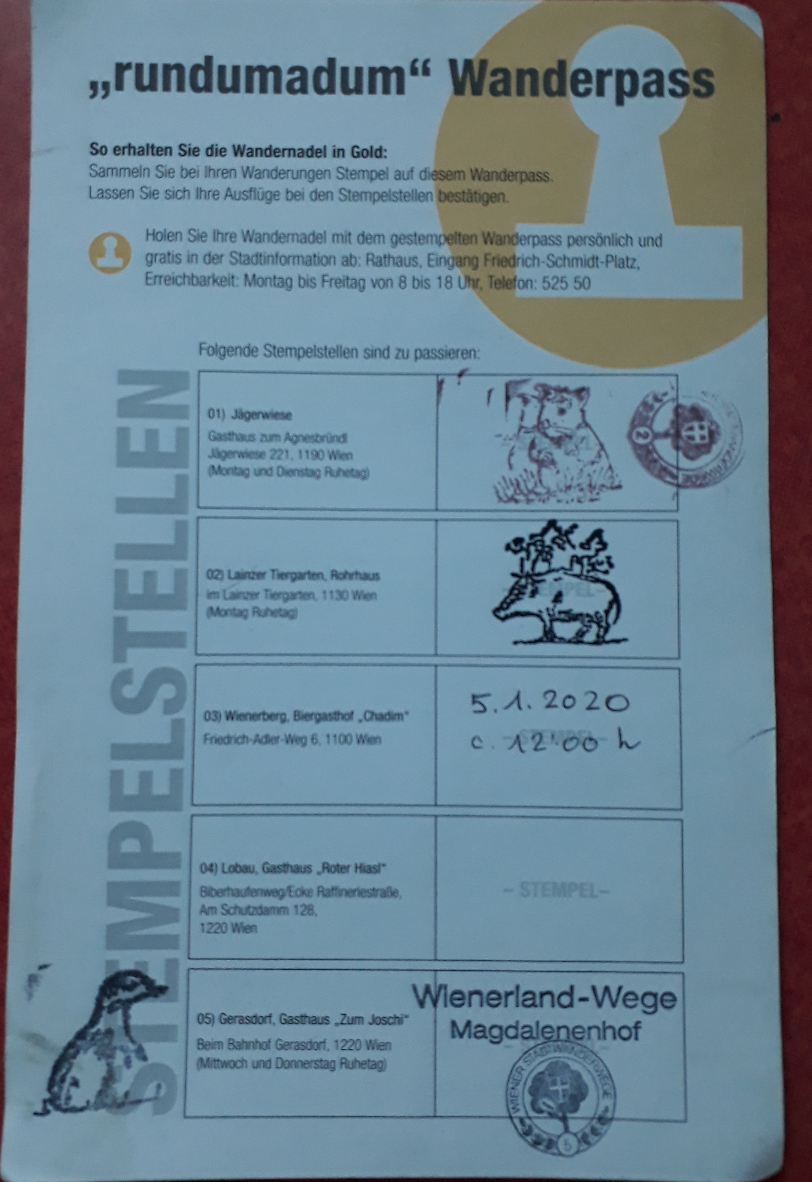
We are nearing the end of the Rundumadum. In fact, because I started with the last leg of the trail, I have now come full circle. I do still need to get the stamp from the Roter Hiasl restaurant in the Lobau as they were not open when we passed that way. Then I will be eligible for my City of Vienna hiking pin. 🙂
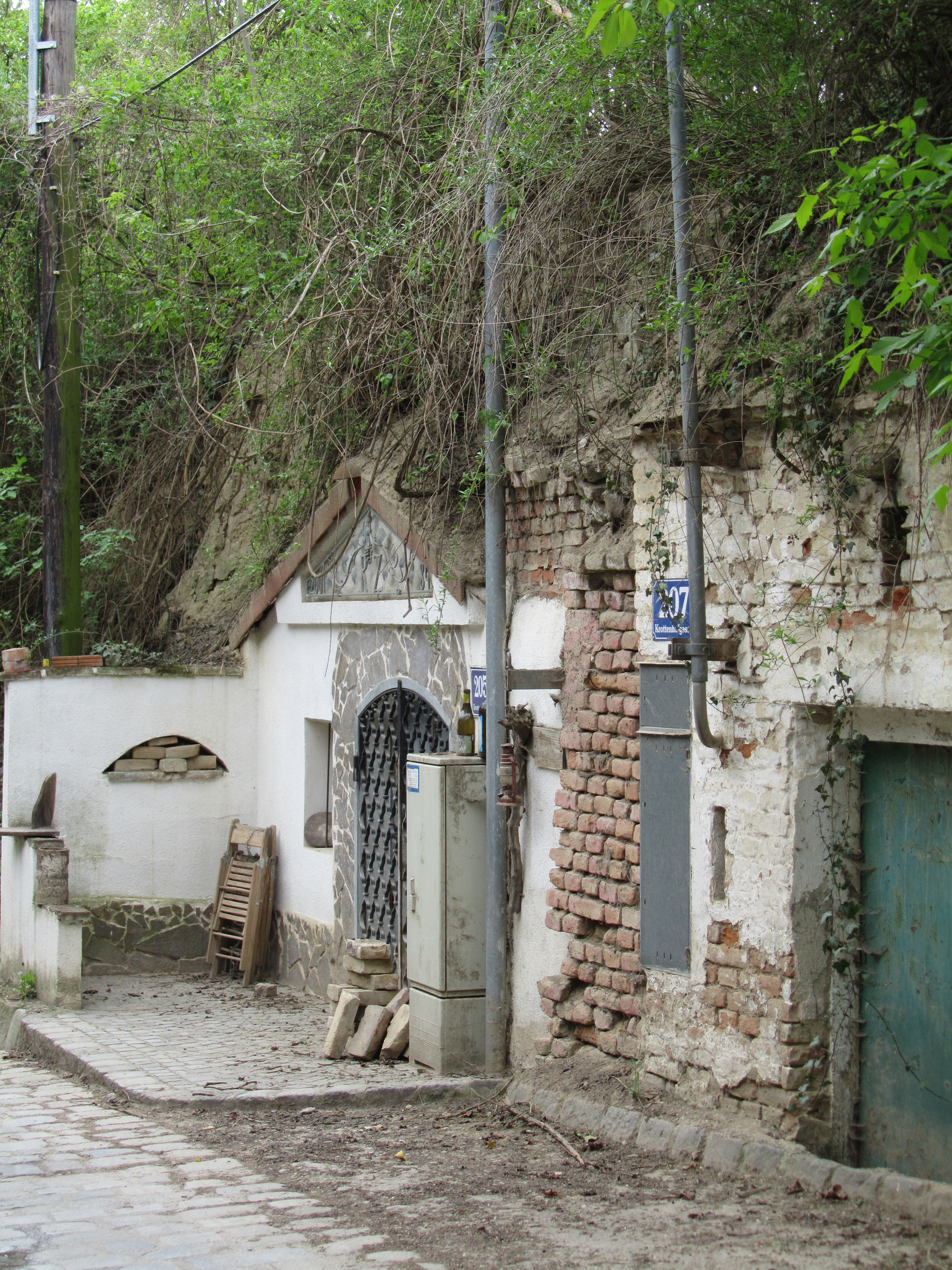
But I am getting ahead of myself, which is a pity because the start of this stretch was so enticing (not just because the bus took us uphill and we only walked downhill ;-)). Here it is, an old “Kellergasse” within the city limits.
An old “Kellergasse” in Vienna’s 21st district
What is a “Kellergasse”? Many will already know that a “Keller” is a “cellar” and, in this case, a wine cellar, and a “Gasse” is a narrow street or alley. They are (or were) common in wine-growing regions and were used to store wine before it was sold. Now, many people are buying them up and converting them into weekend retreats. As they are typically in rather green and agricultural areas, they make good retreats.
We followed Krottenhofgasse all the way down into Strebersdorf (one of the many villages that were incorporated into Vienna), oohing and aahing over the many flowering shrubs, which were at least two weeks behind what they are in town.
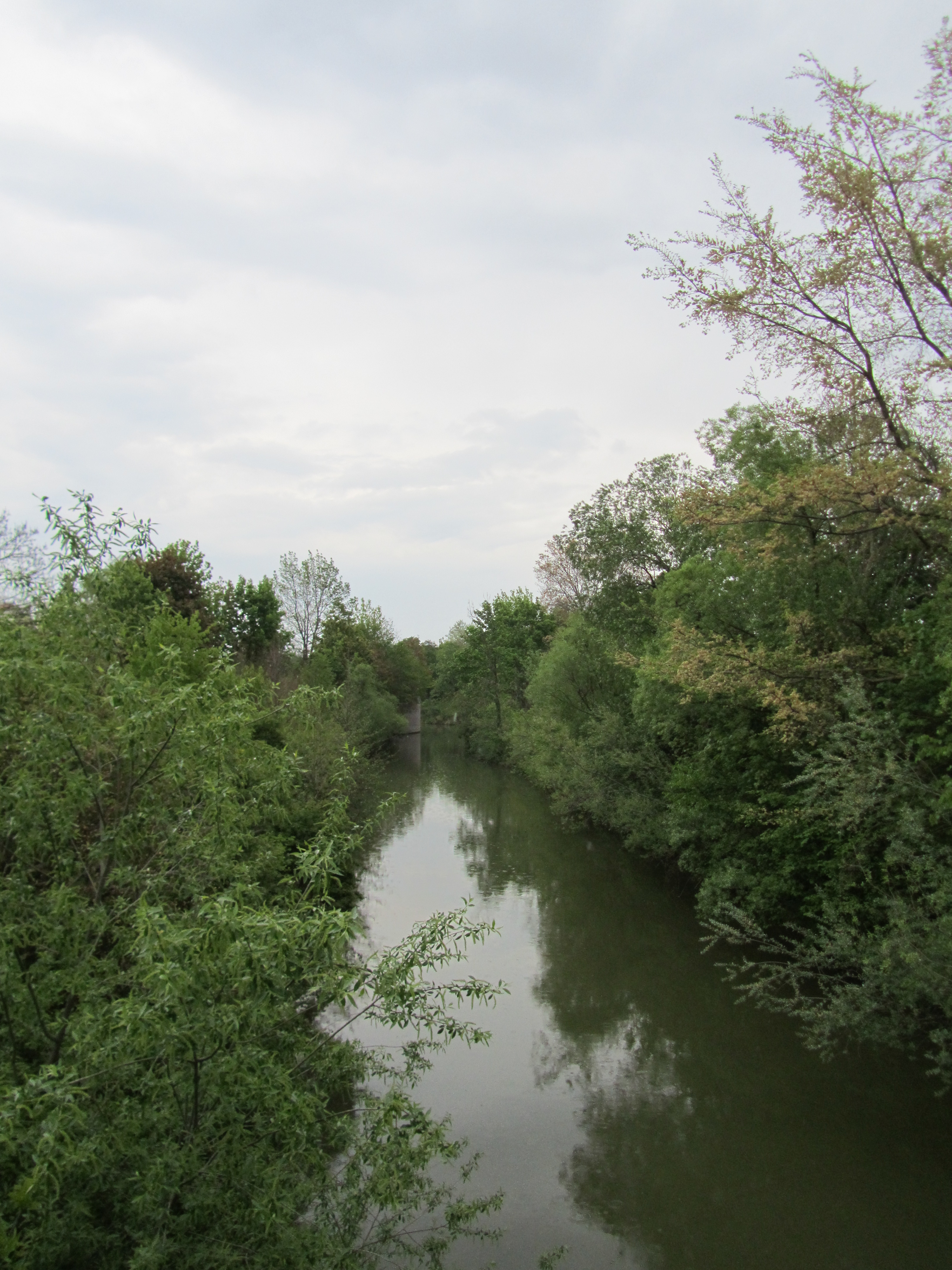
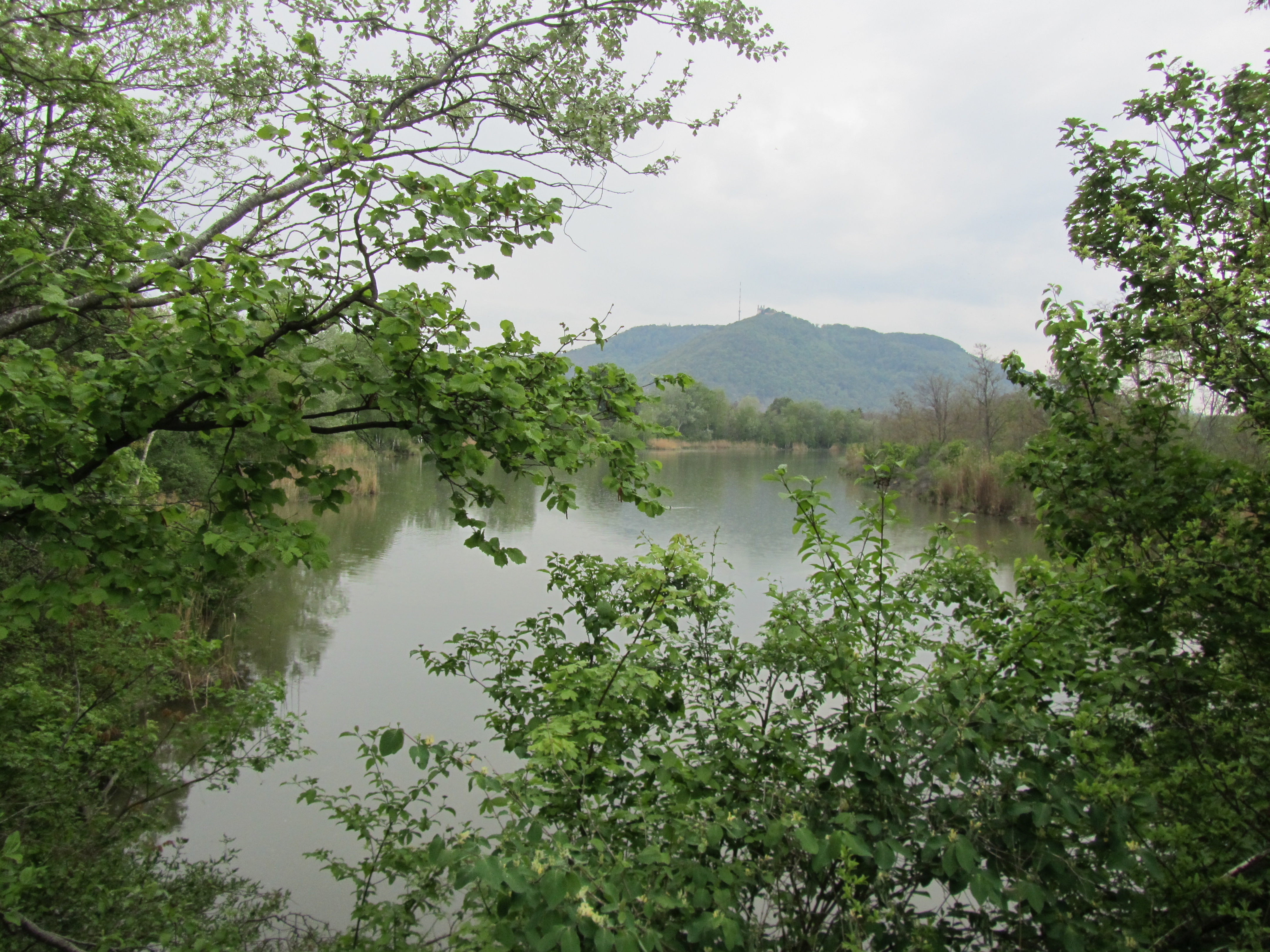
In Strebersdorf, we linked up with the Marchfeld Canal again, part of which we had seen on one of the earlier stretches, and carried on in even as it started to rain, noting the many places you could go down to the water and presumably swim. I couldn’t say I’d be very tempted as the water was pretty murky, but it might be nice to have the option nearby on a hot day.
On the left is a stretch of the canal that had an unidentified round structure on the shore (barely visible on the lefthand side) and on the right is a view still of the canal, although it looks like a lake or pond, with a glimpse of the church at the top of Leopoldsberg on the other side of the Danube (not visible). You can see from the photos that the weather was not bright, to employ a bit of understatement.
As has happened before, we at some point lost track of the Rundumadum signs and had to find our own way. We navigated, rather unusually, by checking out the bus route and managed to find our way to the 34A, which took us back to Floridsdorf. And just in time. By the time the bus pulled into Franz-Jonas-Platz in front of the U6 station at Floridsdorf it was coming down pretty heavily.
A week ago, my walking partner and I (and Maylo, of course) walked the 22nd stretch of the Rundumadum trail. It’s amazing to me how the landscape changes. After all, we are circumnavigating only one city.
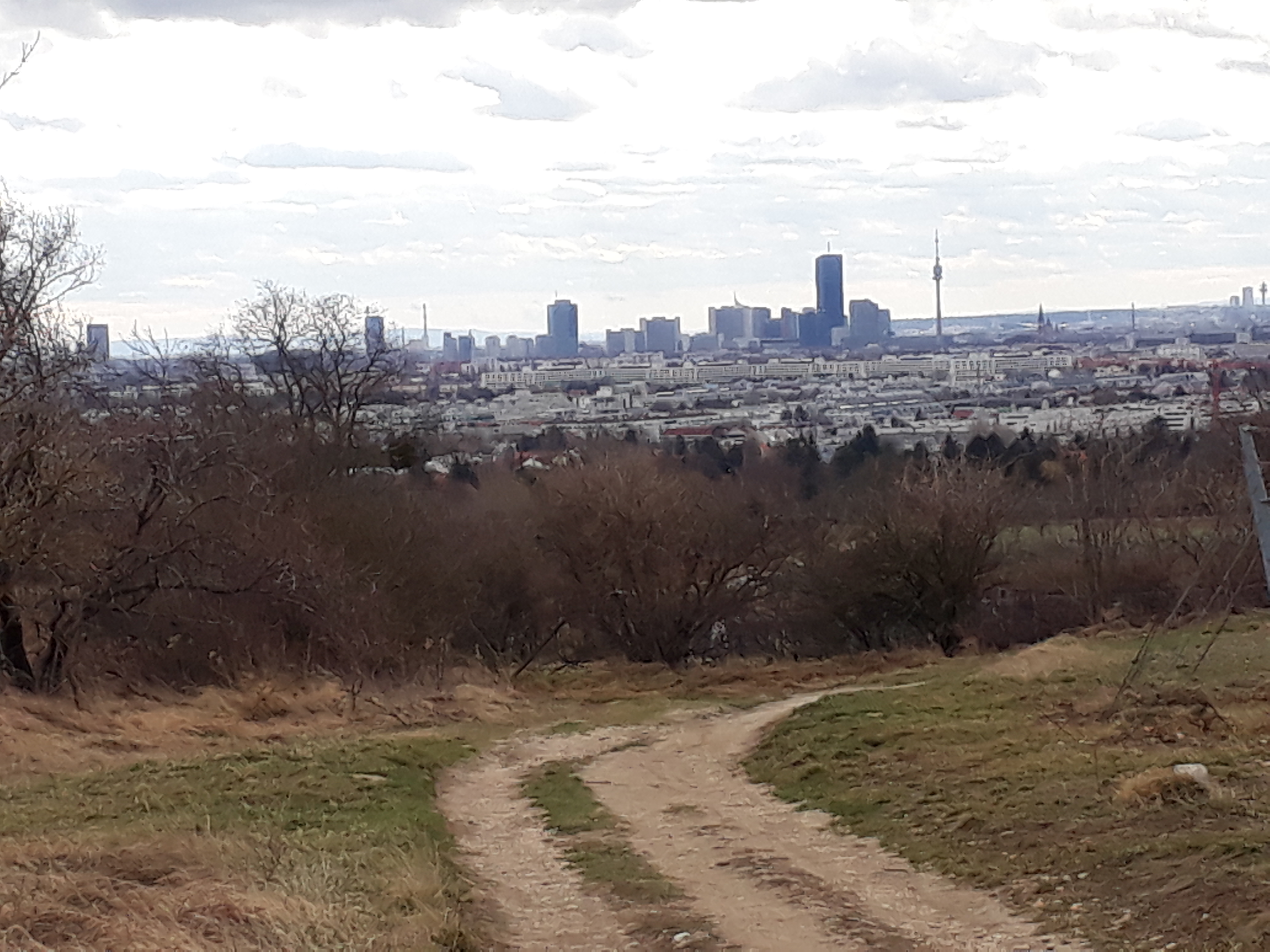
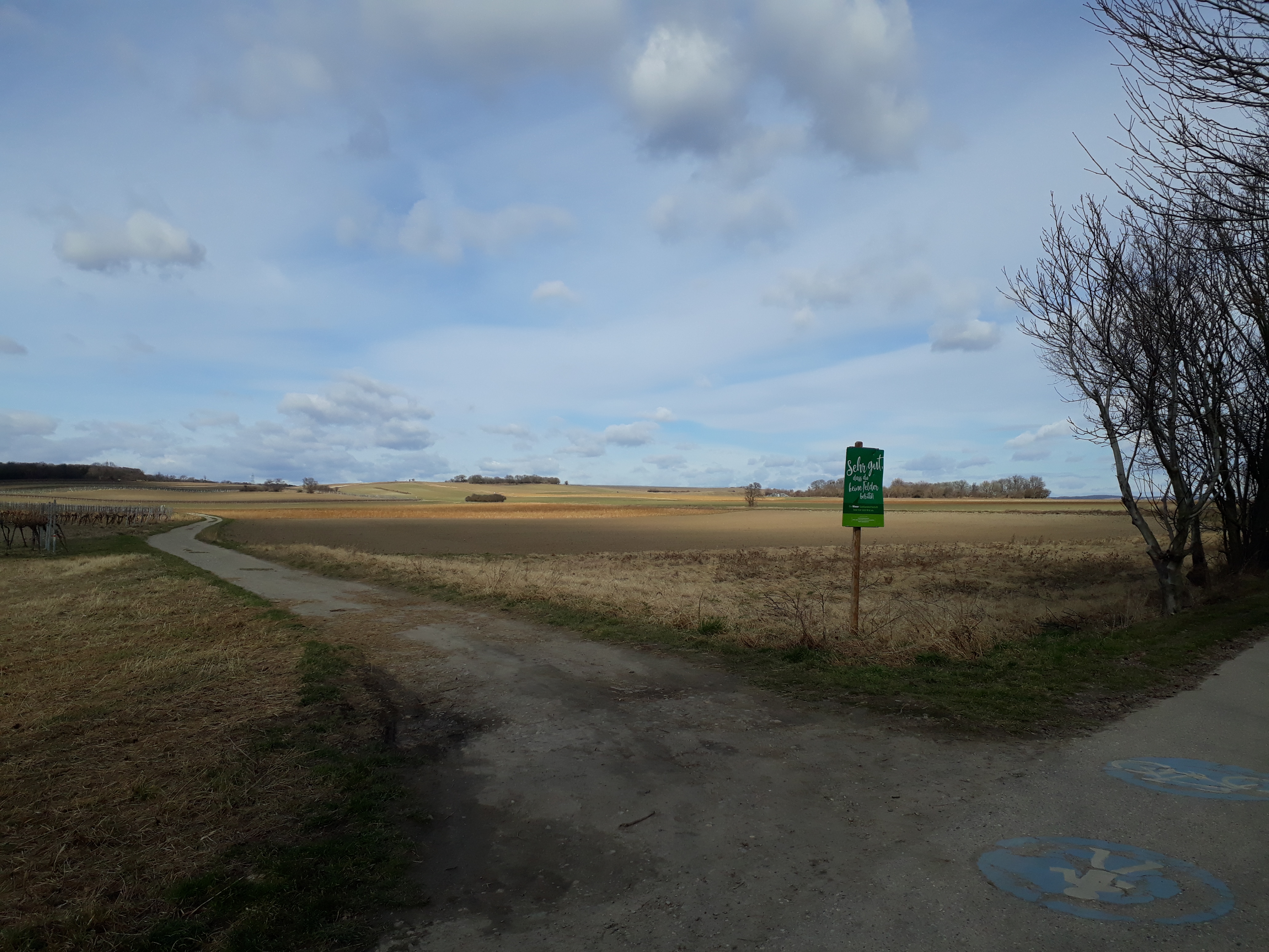
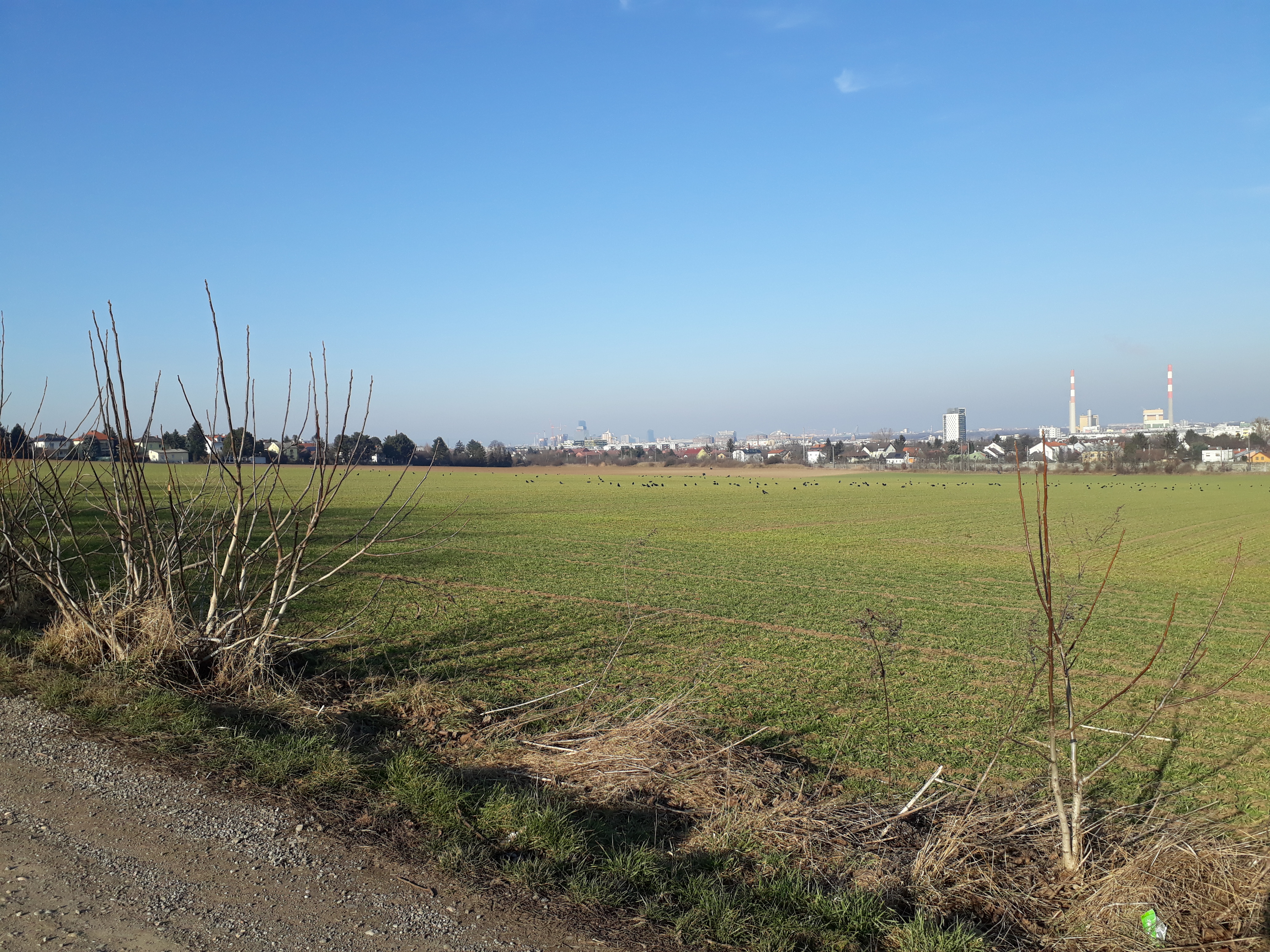
This time we walked through rather bleak vineyards (well, it is still February) and then open fields on the flat, with a view of Vienna on one side and of Lower Austria (not shown) on the other, before climbing up a stretch of Bisamberg and heading back to Hagenbrunn.
I’ve walked this route before but in the other direction when doing the Stadtwanderweg (city hiking trail) number 5 with a friend. In addition, I have pleasant memories of snacks on Bisamberg before Bergheuriger Langer closed its doors forever, a stop once at the Magdalenenhof, and enchanting coppices (or copses).
It was a pleasant, uneventful hike — even the buses ran when they were supposed to. 😉 We only did one stretch, which turned out to be just right. Anyway, I’ll be going back to re-visit the Heurigen (wine taverns) out that way when the weather gets warmer.
The Magdalenenhof, as you can see at the bottom, is a Stempelstelle or place to stamp one’s Rundumadum card, necessary for getting the hiking pin of the City of Vienna.
Today we carried on with the second half of Trail 18 and more than all of Trail 19 (we missed a sign and probably went about 2 kms out of our way). And today I have photos! 🙂
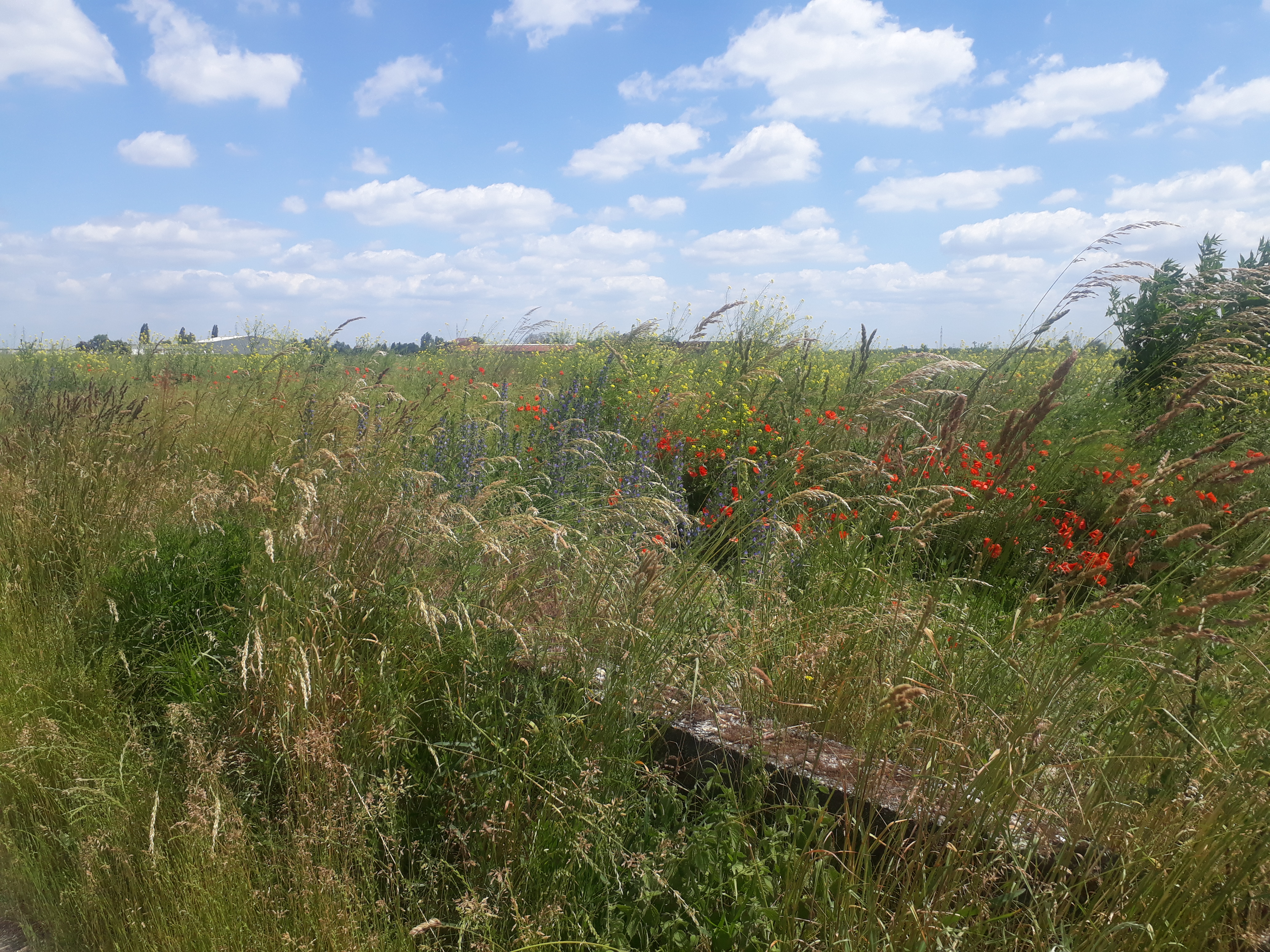
It was a beautiful sunny day (although with such a wind that a friend sent a message: “Hopefully you will not get blown away!”) with beautiful flowers (see above), including lots of elderflowers (visible on the left of the photo below), which my hiking partner collected to make syrup, and some interesting wildlife. We saw a bird that neither of us had ever seen before and I couldn’t find in my field guide and which I think may, in fact, be a pet that escaped and is now living it up in the fields of the 22nd district. In shape it had some similarities to a dove but was much larger, had bright blue markings on its head, and interesting black and white striping on its tail. If anyone has any ideas, please let me know.
We were still in a very flat part of Vienna with scattered small bodies of water. It is still quite rural (see below) and had horses! As with other parts of the Rundumadum trail, I was amazed to see food being grown on a relatively large scale (the 10th district also has proper fields with grain and vegetables). From the underground train you can see extensive greenhouses and the paths we took today were almost all through open fields. Really extraordinary for a city of almost two million people. Long may it last.
This was such a nice stretch that I would like to come back and perhaps even swim in the Süßenbrunner Teiche (ponds).
You can see I’m getting sloppier in the execution of (as well as the writing about) the Rundumadum hiking trail. Half of 18? Really? I don’t think it’s entirely my new hiking partner’s fault, but I must say he’s more ambitious than I am (trying to do two or three at a time) and in this case we didn’t manage to do the whole two stretches on 2 May 2021. (You can see I’m trying to catch up in my reporting of progress, even though I in this case didn’t take any photos.)
It may have been the discouragement of arriving at the U2 Seestadt station and then not being able to find the bus we were supposed to take (and this on a Sunday when nothing runs as often as on other days) so having to wait almost half an hour or it might have been the considerable and rather unpleasant wind blowing across that very flat part of Vienna (Transdanubia) on a steely gray day or it could have been the frustration of the detour along the road instead of through the fields ostensibly because of construction, where the U-Bahn line they were supposed to be working on was completed several years ago. (It turns out the City of Vienna is not perfect! ;-))
In any case, we did get discouraged and stopped halfway through the second stretch. We enjoyed the walk through neighborhoods neither of us knew before, though, as well as through fields that may not much longer be fields (this part of Vienna is being developed very rapidly) and past Himmelteich (~ Heaven’s Pond), one of the small bodies of water that is so common in the east of Vienna. We also enjoyed a picnic before we got the underground back to the city center, eating cheddar and spinach muffins and bananas in an out-of-the-wind spot in what will one day be a park across the street from Nelson-Mandela-Platz.
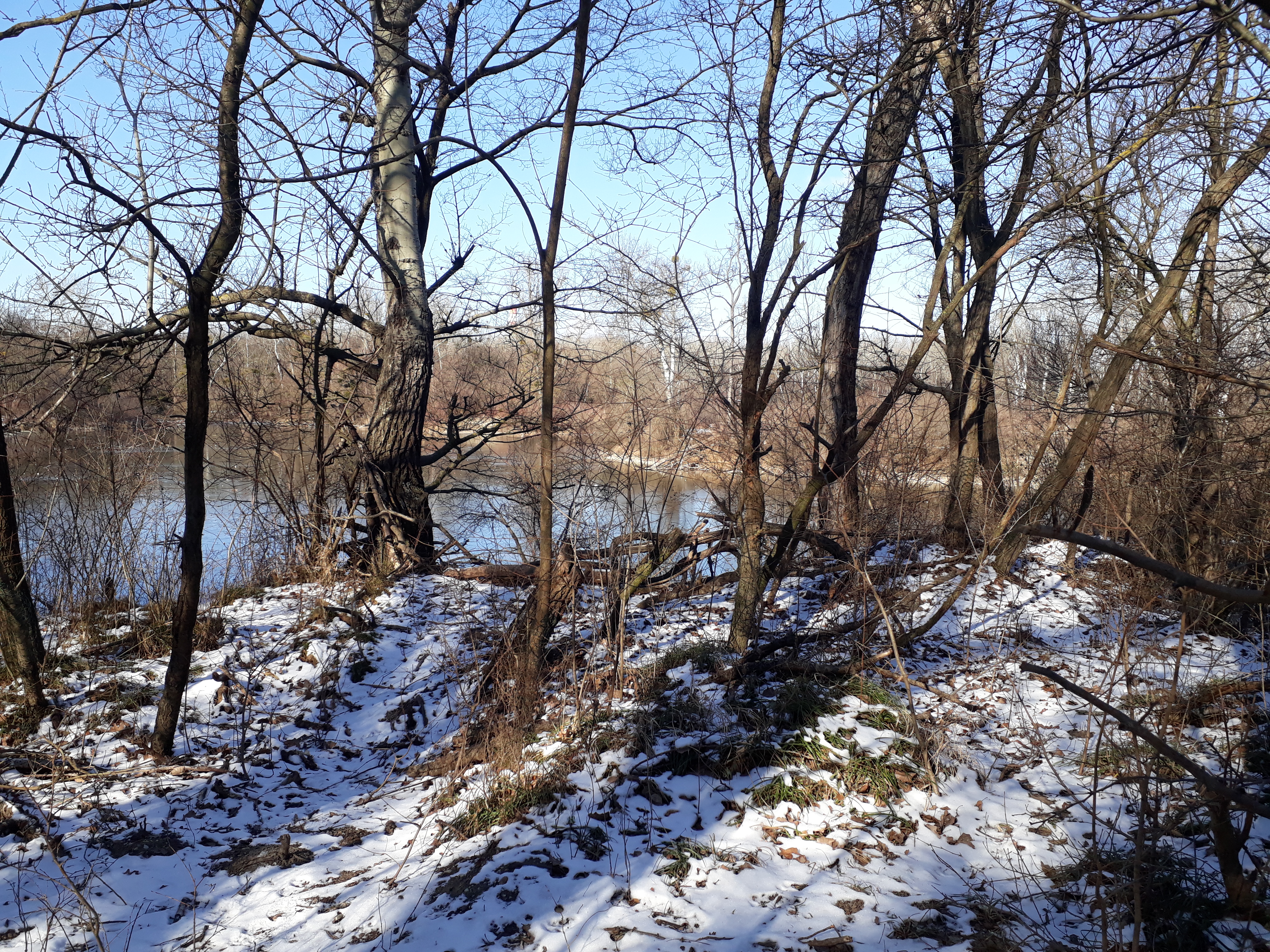
It seems a bit strange to be writing about this on a summer afternoon. We actually did this walk in February on one of the coldest days of the year on a sheet of ice (some of which is visible on the photos). We were concentrating so hard on not falling down that (a) we missed a turn-off and ended up doing three stretches rather than the two we planned and (b) I, at least, could hardly move on Monday my body hurt so much from the strain of trying to stay upright! (This, I remember. ;-))
It was a beautiful walk though (even without Maylo, my dog, who stayed at home).
This was where it started:
And this was where it finished:
As you can see, this part of Vienna has a fair amount of water. In fact, it word “au” in the name of this region, Lobau, means “water meadow” or “wetland”. It’s a very precious ecosystem with some rare species and is endangered by plans to build a tunnel through it to enable car drivers coming from the east to get into Vienna more quickly. (How 20th century is that?!?) It hardly bears thinking about and I try not to. If it comes to protests, though, this seems like a good place to put my protesting energies.
In February, when we were there, Vienna had been in hard lockdown since the day after Christmas. About the only thing we were allowed to do, other than go to the grocery store, was to walk outdoors and so it came that even on this very cold and slippery day there were more people on the trail than there usually would be on a beautiful spring day.
I’m afraid that is about all I remember about this hike. A lot has happened since then. I did want to mention it though.
Full disclosure: The walk itself was three weeks ago. This is the first chance I’ve had to post in anything like the detail I would like. There is something to be said for this coronavirus lockdown.
So, I know! Two in one! Well, they were short and the public transporation routes to get there were relatively long … Also I was hiking with a friend. And wouldn’t you know it–I warned him that I had hardly had a walk along the Rundumadum trail without getting lost but we didn’t get lost once. He must have thought I am unusually incompetent at finding and following trail markers!
What was special about this for me, on top of the fact that we crossed the Danube canal and the Danube itself (see photos), was that once again in the middle of a residential area in the 11th district there were fields to walk through. Vienna is such an amazing city that way.
It was an easy walk (this part of Vienna is very flat) and I remember the the weather being a bit friendlier than it looks in the photos. It was chilly though. Difference between a New England upbringing and an Austrian upbringing, albeit in Carinthia where they still get proper winters? I didn’t bother to bring gloves because the forecast said it would be 12°C and my friend wore gloves because we were only going to get 12°C. (Mind you, I’ve gotten soft after over 30 years in Austria. I wished I had had gloves!)
Special sights along this trail other than the fields and the Danube: some early blossoms, some rather ugly public housing from the 60s and 70s, the Cemetery of the Nameless, where unknown dead who are fished out of the Danube are buried, a hydroelectric dam, and, more or less at the end of the route, a famous Gasthaus, Roter Hiasl. (To be precise, we didn’t actually go through the cemetery. We walked by it and talked about it. Then, for me, it was quite exciting to finally find out how to pronounce the name of the Gasthaus and why it is pronounced the way it is–“Hias” is short for “Matthias” and the “L” on the end makes it diminutive. In translation the name of the restaurant would be something the Little Red Matthew.)
We caved and stopped at Little Red Matthew’s place. We didn’t quite make it to the Waldschule. Next time …
This stretch we did a week ago, all in one go. We tacked on about two kilmeters by missing a turn, but it still felt like a miracle after the missteps and detours of the last two stretches. And because of the extra stretch I discovered a “Weinschenke” (like an even more rustic Heuriger) that I would like to try out another time.
And, boy, did this stretch have its beauties. I like my usual stomping grounds–in the northwestern part of Vienna–because there a hills and woods as well as meadows (and vineyards :-)). This part of Vienna, still in the 10th district, was an extremely pleasant surprise. This is a part of Vienna where food is grown, within the city limits. I hope the photo of the fields catches some of the sense of space and almost rural character.
One of the reasons I write “almost rural” is the amount of traffic. There aren’t many cars–we finally got away from the Autobahn in the other part of the 10th district–but the buildings you see in the photo are on the other side of railways tracks and the hiking trail is right under a heavily traveled route to Schwechat, the Vienna airport.
As you can see, it was a beautiful day and lots of people were out, with dogs, without dogs, on bicycles, on foot, scruffily dressed, nicely dressed (perhaps on their way to Sunday lunch at grandma’s?), quickly, in a leisurely manner, in groups, and alone. I always think you see on Sundays in the Vienna Woods and environs how the Viennese actually survive the traditional diet of Wiener Schnitzel and so on. They get out and walk. Long may it continue!
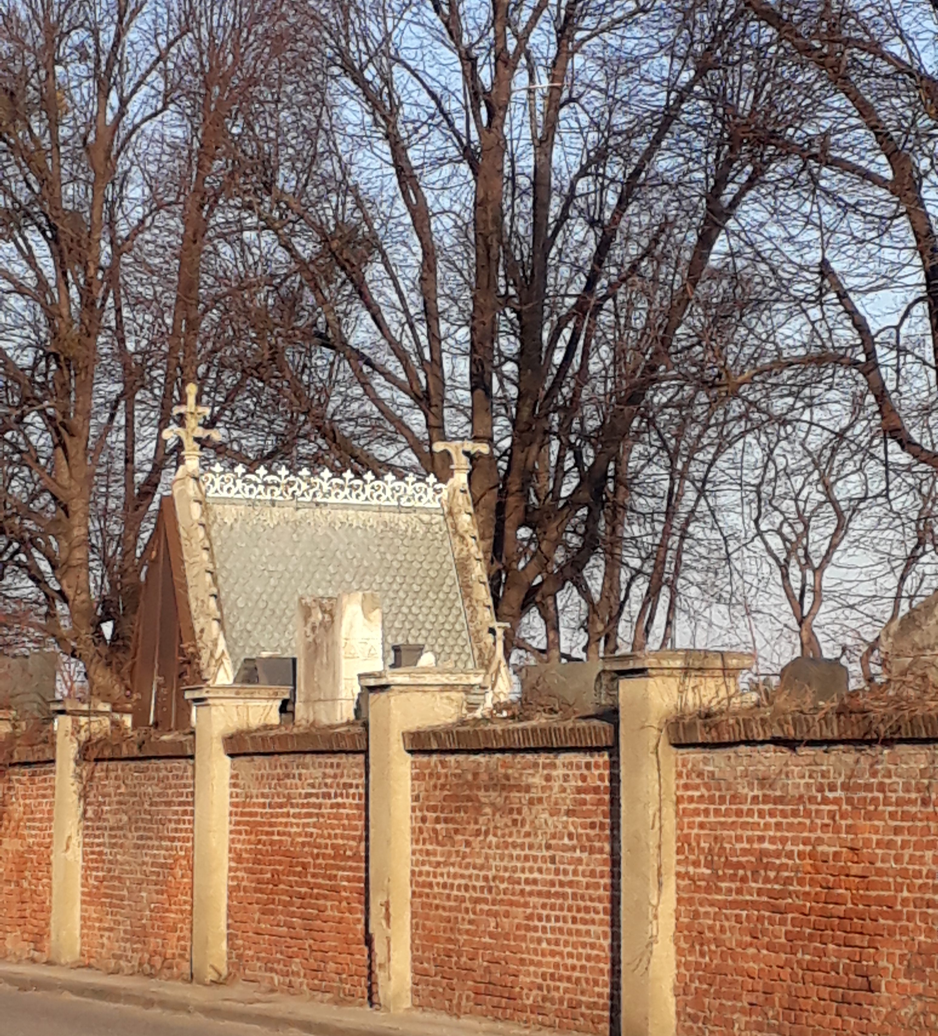
This stretch takes you to the famous Zentralfriedhof, where people like Johannes Brahms, Ludwig van Beethoven, Johann Strauss, Theodor Billroth (Austrian medical pioneer) and the late presidents of Austria are buried. There is an honorary grave here for Mozart, who, as most of you know, was actually buried in a communal grave in St. Marx. Surely, there are many important non-musical people buried here but my Baedeker’s–a guide book after my own heart–mainly lists the musical ones.
Understandably, dogs are not allowed in so an alternate route was provided along the wall. We still got to see a bit of the cemetery, when we weren’t dodging bikes on the pedestrian / bike path.
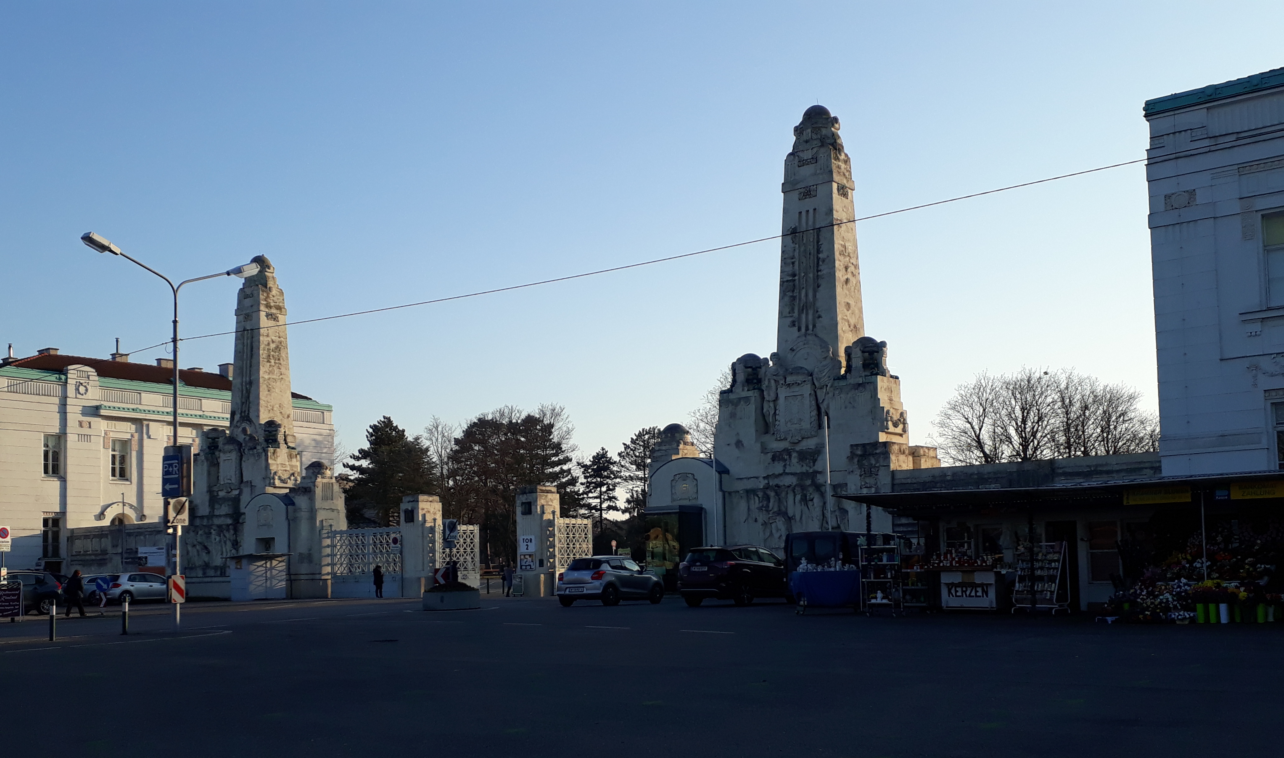
The last stretch for us, along the tram tracks of the 11 and 71 trams was not so nice. In fact, I almost gave up on got on at the first gate to the cemetery rationalizing that we could make up that stretch by starting there next time, but the idea of actually finishing one of these routes for a change motivated me to keep going.
Not a great photo (below) but here is proof that we walked all the way to the main gate before getting on the 71 and going home.
Distance: 5.3 km
Time: 1 1/4 to 1 3/4 hours. We, of course, took longer given that we unintentionally added quite a stretch to our walk. (Also think the alternative route for dogs was a bit longer in this case.)